The Exploratorium’s reuse of Pier 15 bodes well for an S.F. waterfront renaissance.
TWENTY YEARS FROM TODAY, when people picture San Francisco, what will come to mind first? Our hills? A bridge? Painted Ladies? Salesforce Tower?
How about our piers?
If all goes according to plan, the city’s finger piers will join those other monuments as icons of the City by the Bay.
Few cities anywhere have as many finger piers that remain historically, if not always structurally, intact. They are relics of the glory days of shipping that began in the 1840s and prevailed in San Francisco well into the 20th century.
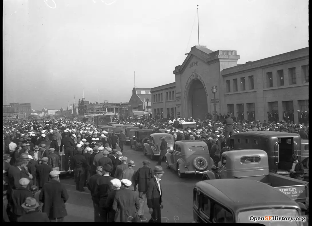
For most of that time in the city, shipping infrastructure hindered public access to the waterfront, much of it sited on land created by the stone-and-concrete Embarcadero Seawall, which the city built over four decades starting in 1878. Even after World War II, when shipping operations moved to San Francisco’s central and southern waterfronts, the northeast waterfront remained blocked. Piers fell into disuse. In 1968 the Embarcadero Freeway stood in front of not just the finger piers but the Ferry Building as well.
Then, in 1978, developer Warren Simmons turned one of the crumbling piers into what eventually became the third-biggest tourist trap in the United States: Pier 39.
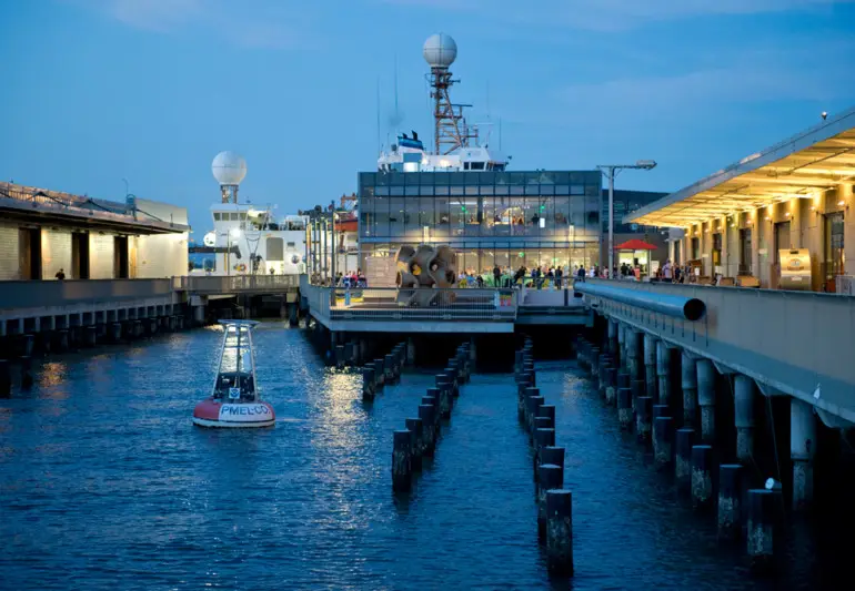
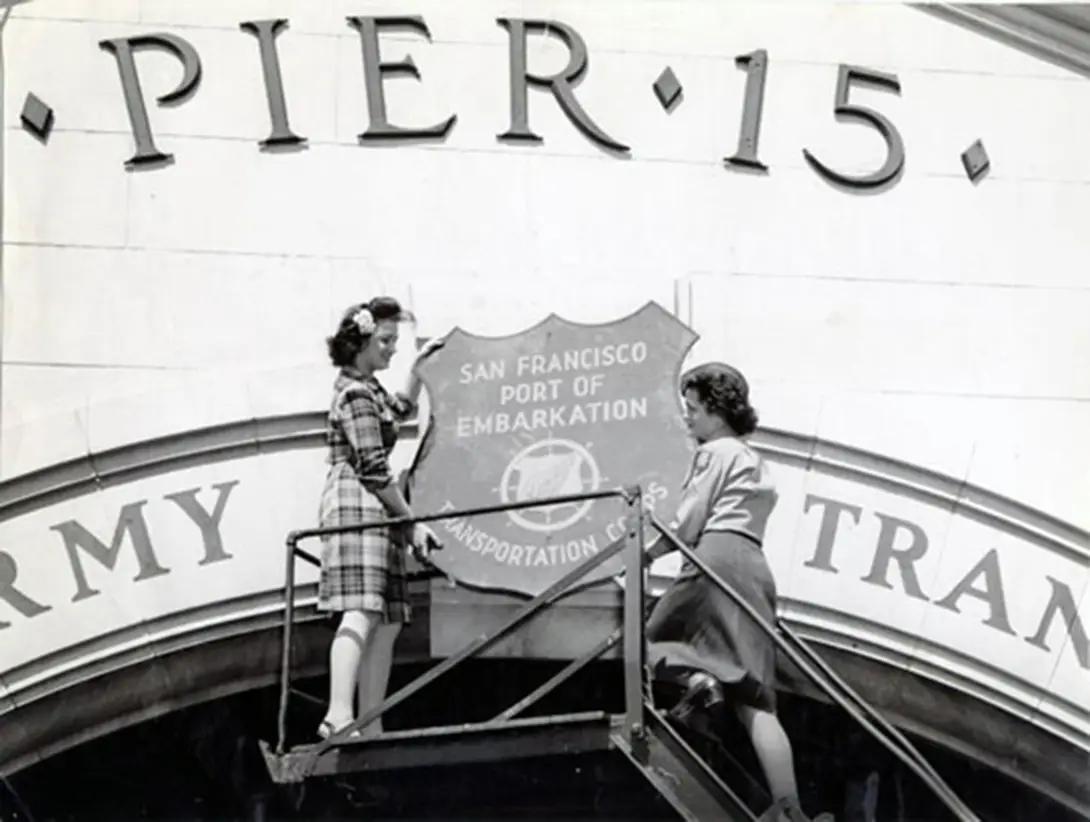
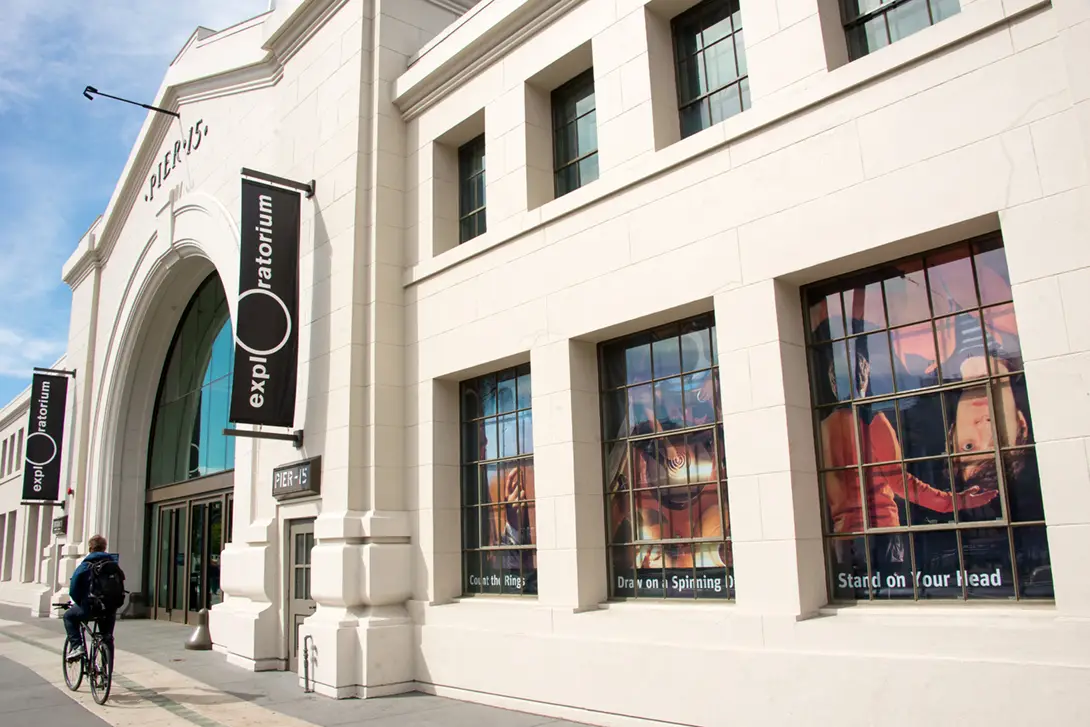
Six years ago, another decaying pier became a major draw — Pier 15, now home to the 330,000-square-foot, hands-on, kids-just- love-it Exploratorium museum. Founded in 1969 by physicist Frank Oppenheimer and originally located at the Palace of Fine Arts, the museum this year celebrates its 50th anniversary. The Exploratorium these days is also a center for citizen science, thanks partly to an offshore National Oceanic and Atmospheric Administration research buoy that measures bay water quality, tidal action and turbidity. The museum additionally leases Pier 17, which is yet to be fully restored, with plans to one day integrate it into the Exploratorium campus.
The Exploratorium’s move to Pier 15 in 2013 followed other recent pier restorations between there and the Ferry Building that further opened up the waterfront for public enjoyment. Today visitors wander the restored Piers 1, 1 1⁄2, 3, 5 and 7. A bayside history walk passes restaurants, bars and ferryboats used for tours and parties.
Many of the city’s other piers remain empty or are occupied by parking lots and garages while the Port of San Francisco seeks deep-pocketed developers to initiate other uses. Costs for restoring rotten pilings and decayed decks and sheds are enormous.
Adding to the challenge: the Embarcadero Seawall, built on mud, will not withstand a major earthquake, and the land behind it is expected to flood as sea levels rise. The city plans to spend billions to strengthen the seawall — and probably billions more to fend off rising waters.
The Exploratorium’s arrival on the bay helps the public better understand the city’s waterfront setting, says Susan Schwartzenberg, an artist and curator who has been with the museum 35 years. Besides restoring the pier and the 1931 concrete shed and bulkhead facade, at the end of the pier the museum added a two-story “Bay Observatory,” a glass-walled gallery for environmental education. By moving to the bay from an inland site, the Exploratorium can now illuminate “the relationship of the city and the bay, the built and natural environment, right on the urban edge of San Francisco Bay,” Schwartzenberg adds. “It helps people understand the space where we’re living, what humans have done to change it. It encourages people to think, What do we need to do to make sure that with sea level rise, we can adapt and be able to still stay here?”
Contemporary images courtesy of the Exploratorium. Historical images courtesy of Western Neighborhoods Project/Opensfhistory.org, SF Public Library.
This article originally appeared in SPACES’s print edition under the headline: “Pier Pressure”.
 David Weinstein is a longtime El Cerrito author and journalist whose books include It Came from Berkeley: How Berkeley Changed the World and Signature Architects of the San Francisco Bay Area. He was a reporter and editor for many years at the West County Times and Contra Costa Times. He also wrote a popular series of profiles of Bay Area architects for the San Francisco Chronicle. Today he is features editor for CA Modern. He’s also the leader of El Cerrito Trail Trekkers and Friends of the Cerrito Theater.
